The term “Spatial Computing” is rapidly moving from academic circles and tech keynotes into the mainstream lexicon. But what does it truly mean? Is it just a fancy new name for Virtual or Augmented Reality?
The answer is a definitive no. Spatial Computing is a foundational shift in how we interact with technology. It’s not a single device or application; it’s a new paradigm where the computer ceases to be a distinct object—a phone, a laptop, a screen—and instead integrates seamlessly into the physical space around us.
This article provides a scientific and technical breakdown of Spatial Computing, dissecting its core principles, technological stack, and transformative potential.
Defining the Paradigm: Beyond the Screen
At its core, Spatial Computing is a form of human-computer interaction that uses the surrounding physical space as the medium for interaction. It creates a unified field where digital content and the real world can coexist and interact in real-time, governed by the laws of physics and spatial logic.
Think of it this way:
- Traditional Computing: You look at a screen (2D). You interact with a mouse and keyboard.
- Spatial Computing: You interact within a space (3D). You use gestures, gaze, voice, and movement.
The “spatial” in Spatial Computing refers to the system’s ability to understand, model, and engage with the three-dimensional geometry of an environment. This is the critical differentiator.
The Core Technological Pillars of Spatial Computing
For a machine to “compute” spatially, it relies on a sophisticated stack of technologies working in concert. Here’s a breakdown of the essential components.
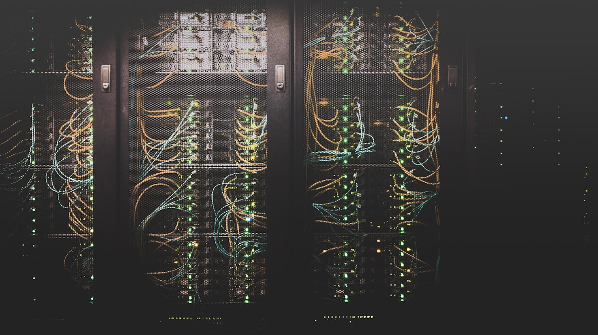
1. Sensing & Perception: The Digital Nervous System
This is how the system “sees” and “feels” the world. It involves a suite of sensors that capture raw data about the environment.
- Cameras (RGB): Standard cameras capture color and texture, useful for object recognition and basic tracking.
- Depth Sensors: These are crucial. Technologies like Structured Light (projecting a pattern of infrared dots and measuring deformation), Time-of-Flight (ToF) (measuring the time it takes for a laser pulse to return), and Stereo Vision (using two cameras to calculate depth like human eyes) create a real-time 3D map of the environment.
- Inertial Measurement Units (IMUs): These sensors, including accelerometers and gyroscopes, track the device’s (or user’s) own movement, orientation, and acceleration. This provides high-frequency data that complements the visual tracking from cameras.
- LiDAR (Light Detection and Ranging): A laser-based method that fires rapid pulses of light to create a highly precise “point cloud” map of the environment. It is exceptionally good at capturing fine geometric detail, even in low-light conditions.
- Microphones: For capturing audio and enabling voice commands, which are a natural part of spatial interaction.
2. Scene Understanding & Spatial Mapping: Creating a Digital Twin
Raw sensor data is useless without interpretation. This layer processes the data to create a meaningful model of the world.
- Simultaneous Localization and Mapping (SLAM): This is the cornerstone algorithm of Spatial Computing. SLAM allows a device to simultaneously:
- Localize: Determine its own position and orientation within an unknown environment.
- Map: Construct and update a 3D map of that environment.
- SLAM algorithms fuse data from cameras, depth sensors, and IMUs to create a persistent, real-time geometric understanding of the space.
- Semantic Understanding: This is the next level of intelligence. Beyond just geometry, the system identifies what objects are. Using machine learning models trained on vast datasets, the system can classify surfaces (a floor, a wall, a table), recognize objects (a chair, a cup, a person), and even understand their properties (this surface is horizontal and can support digital objects).
- Occlusion: A critical aspect of realism. The system must understand when a real-world object should block (occlude) a digital one. If you place a virtual cup behind a real monitor, the system must ensure the monitor hides the cup from view.
3. Rendering & Display: Blending the Real and the Virtual
Once the world is understood, digital content must be presented convincingly within it. This happens through specialized displays.
- Optical See-Through (OST): Used in AR glasses like Microsoft HoloLens. These displays use waveguides or holographic optical elements to project digital imagery directly into the user’s field of view, allowing them to see the real world with digital overlays. The challenge is achieving a wide field of view and high brightness.
- Video See-Through (VST): Used in VR headsets like the Meta Quest 3 when in “passthrough” mode. External cameras capture the real world, and the system composites the video feed with digital content before displaying it on the internal screens. This allows for more control over the blend but can suffer from latency and lower resolution.
- Foveated Rendering: A performance-saving technique that uses eye-tracking to render the area where the user’s fovea (the center of the eye) is looking in high detail, while rendering the peripheral vision in lower detail. This dramatically reduces the computational load.
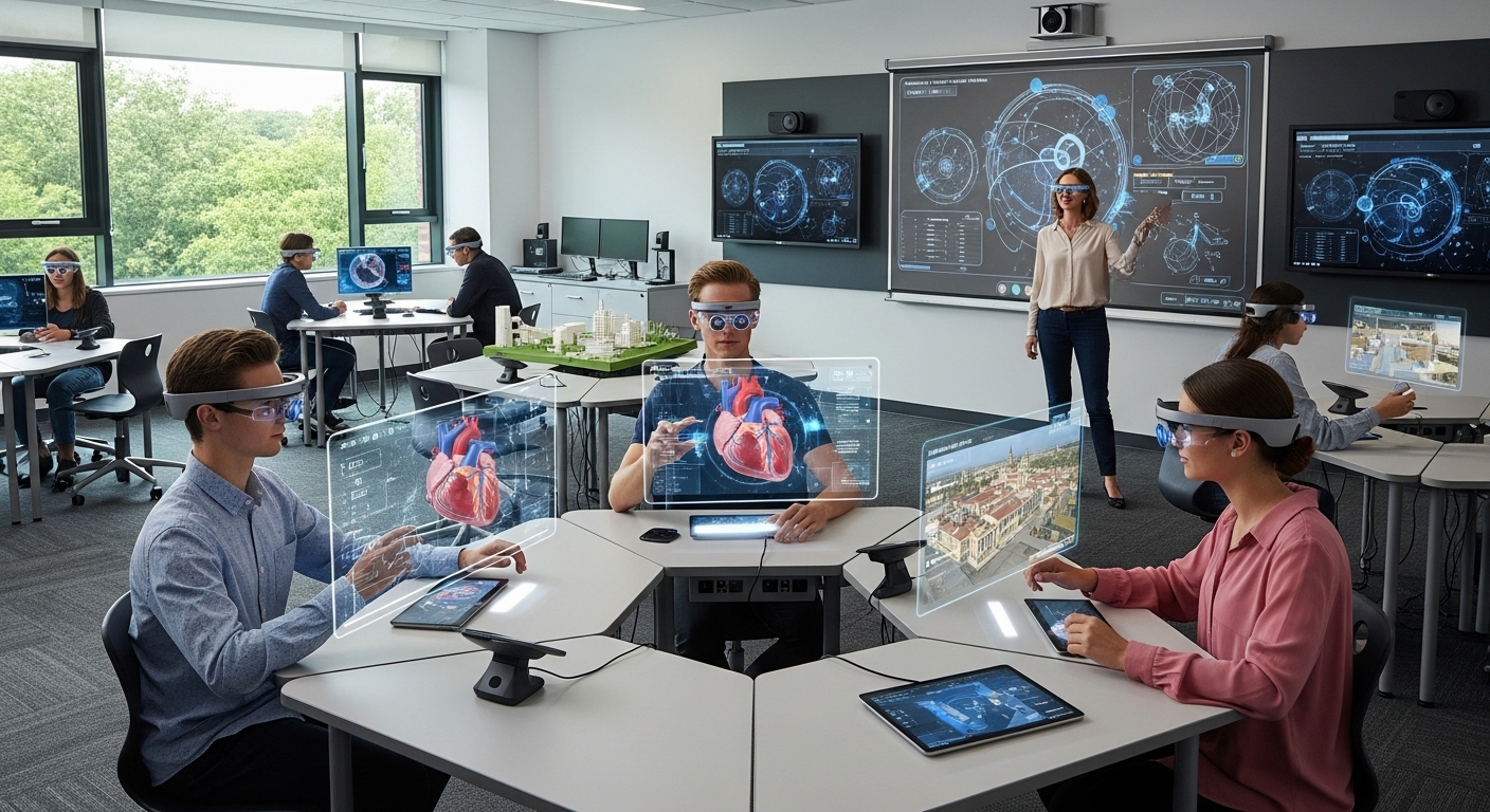
4. Interaction & Interface: A New Language of Control
Spatial Computing demands new forms of input beyond the mouse and keyboard.
- Hand-Tracking: Using cameras and computer vision to track the user’s hands, fingers, and gestures. This allows for direct manipulation of digital objects—grabbing, pushing, pulling, and rotating.
- Eye-Tracking: Used not only for foveated rendering but also as an input method. Users can select items just by looking at them.
- Voice Commands: A natural and hands-free way to issue commands and queries.
- Haptic Feedback: Provides a sense of touch, creating tactile sensations when a user interacts with a virtual object, enhancing immersion and realism.
Key Applications: Where Theory Meets Reality
This technological convergence is not theoretical; it’s driving innovation across industries.
- Industrial Design & Engineering: Architects and engineers can walk through full-scale 3D models of buildings or products before they are built, identifying design flaws spatially.
- Surgery & Medicine: Surgeons can overlay 3D scans (like a CT scan) directly onto a patient’s body during an operation, providing “X-ray vision.”
- Logistics & Warehousing: Workers equipped with AR glasses can see optimized picking paths and have item locations highlighted in their field of view, drastically improving efficiency.
- Collaboration: Remote teams can meet in a shared virtual space, interacting with 3D models and data as if they were in the same physical room.
Conclusion: The Invisible Revolution
Spatial Computing represents the next logical step in the evolution of human-computer interaction. It moves us from a world where we must learn the language of machines to one where machines understand and operate within the context of our world. By digitizing and comprehending space itself, it unlocks a future where digital information is not confined to a rectangle in our pocket but is woven intrinsically into the fabric of our reality, augmenting our abilities and reshaping how we work, learn, and connect.